What's new

From Sea to Shining Sea - TAT 2023

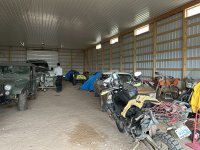
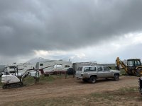
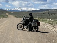
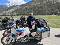
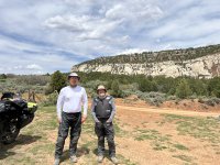
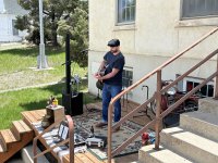
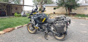
Oops forgot to add pics of our accommodations last night. We met Robert at a gas station while we looked for a place to camp and he let us use his pole barn. He was a very great guy and also is a motorcycle enthusiast. Owns lots of KTM s and thinks he wants to start adventure riding.
 

Attachments

  • IMG_5072.jpeg
    IMG_5072.jpeg
    3.9 MB · Views: 17
  • IMG_5074.jpeg
    IMG_5074.jpeg
    2.2 MB · Views: 14
  • IMG_5075.jpeg
    IMG_5075.jpeg
    1.7 MB · Views: 12
  • IMG_5073.jpeg
    IMG_5073.jpeg
    2.1 MB · Views: 13
Started the day in Salida and started our way west. Took a few shortcuts to try and make a few miles. We then hit the long stretch from highway 50 southeast towards Lake City.

We got half way through the track and encountered a closed gate. Grrrr!! We were less than 40 miles from Lake City. We had to backtrack a long way and then make our way to Gunnison. We continued west on 50 through a ton of construction and then turned south on Owl Creek Pass road. I've been down this a couple of times and it's a great route... although this time it was blocked by snow. Back track again!

Ended up in Montrose Colorado. Tent spaces were $42 EACH!!! We opted for a Days Inn for less. :lol3

Scenes from the day...

i-hQZffZr-X2.jpg


i-8d8QjxD-X2.jpg


i-8Q3JmzM-X2.jpg


i-Pgg4J8M-X2.jpg


i-NSp9bjp-X2.jpg


i-K4XLgGT-X2.jpg


i-qjz2Rmj-X2.jpg


i-mc4X7RS-X2.jpg


i-sCP4tzn-X2.jpg
 
Some more pics of our day. Colorado is beautiful and besides dealing with the snow way less tourists this time of year!!
 

Attachments

  • IMG_5108.jpeg
    IMG_5108.jpeg
    4.1 MB · Views: 11
  • IMG_5106.jpeg
    IMG_5106.jpeg
    1.7 MB · Views: 8
  • IMG_5105.jpeg
    IMG_5105.jpeg
    2.6 MB · Views: 11
  • IMG_5098.jpeg
    IMG_5098.jpeg
    3.1 MB · Views: 9
  • IMG_5097.jpeg
    IMG_5097.jpeg
    2.1 MB · Views: 8
So... today started in Montrose Colorado. Due to the snow still on the ground, we did a little creative routing, and came up with our own version of the TAT for the day.

We rode south to Ouray, made an attempt at Yankee Boy Basin, got turned back by snow and then continued south on the Million Dollar highway. This ride never disappoints!

i-jh8fTVV-X2.jpg


i-BQM39XX-X2.jpg


We went south as far as the infamous Black Bear trail head, and then swung our steeds north to do it all over again.

i-D7LN2vV-X2.jpg


i-fSJDdTh-X2.jpg


Ignore the finger..

i-hXKpKWm-X2.jpg


We then headed to Telluride to check things out.

i-2GdfpDj-X2.jpg


i-6GSRhw9-X2.jpg


Ran into Eric from Germany riding a classic Africa Twin!

i-tCknJWD-X2.jpg


Ended the day in Monticello Utah.

i-kD27SkS-X2.jpg


i-fMh8kb6-X2.jpg


Tomorrow..... Moab!
 
A little perspective of Black Bear pass. "Ain't No Way!!"
20230525_140247.jpg


Here's the famous Last Dollar Ranch on Last Dollar Road. (Where Layla celebrated 10,000 miles)

20230525_125433.jpg


Over the years the ranch has appeared in a number of television commercials, including a 2005 Super Bowl ad featuring the Budweiser Clydesdales having a snowball fight. (That was back when Budweiser was a Man's beer.)
 
You guys are making good time.
We have had a ton of snow and rain in the West this winter, expect more closed passes, especially at higher elevation dirt.
On the plus side, you will probably see epic flower blooms.
 
We left Montrose a few minutes after 8:00. We ran up the highway about half way to Moab, and then swung east to reconnect with the TAT.

We did that easy enough, but soon ran into snow blocking our progress.

i-JdhZssP-X2.jpg


i-BtWt4dJ-X2.jpg


i-fDw43Tv-X2.jpg


We then had to backtrack about 15 miles and finish the run to Moab on the highway.

We then took a custom track I had put together consisting of bits of the Lasal Loop road, Kokopelli trail, and Onion Creek...sort of a "Moab Sampler". :lol3

i-3GGgZWt-X2.jpg


i-fzkXpVR-X2.jpg


i-gcpmH59-X2.jpg


i-FRfhcrV-X2.jpg


i-L7FxXNH-X2.jpg


Moab never disappoints!

i-V6P4zjG-X2.jpg


i-KGj5pHG-X2.jpg


i-wM5J5vH-X2.jpg


It was hot! Low 90's.

i-hPsqxds-X2.jpg


Onion Creek.

i-RsXwCJX-X2.jpg


i-hJB6zXK-X2.jpg


i-zVKKLfh-X2.jpg


Moab was filling up fast due to the holiday weekend, so we escaped north to Green River Utah.
 
Bob led is on the most spectacular ride today! A great mix of challenging terrain and other-worldly views. Pictures just don't do it justice.

If you look closely, all three of us are in this pic
20230526_132358.jpg


20230526_150454.jpg


That's Bob taking the turn way out ahead.

20230526_145632.jpg


Don't know what that green stuff is seeping out of the rocks, but it sure makes for some interesting views
 
Some more pics of our day. Erik from Germany was a highlight of the day. He just finished school to become a teacher and is spending a couple of months seeing our country. Very nice guy.
 

Attachments

  • IMG_5156.jpeg
    IMG_5156.jpeg
    4.8 MB · Views: 12
  • IMG_5178.jpeg
    IMG_5178.jpeg
    2.3 MB · Views: 13
  • IMG_5182.jpeg
    IMG_5182.jpeg
    4.4 MB · Views: 13
  • IMG_5185.jpeg
    IMG_5185.jpeg
    2.9 MB · Views: 11
  • IMG_5192.jpeg
    IMG_5192.jpeg
    4.2 MB · Views: 16
Some pics of our day. 360 miles to see the Bonneville Salt Flats. All pavement but still beautiful riding until it decided to hail on us.
 

Attachments

  • IMG_5203.jpeg
    IMG_5203.jpeg
    2.7 MB · Views: 13
  • IMG_5206.jpeg
    IMG_5206.jpeg
    3.2 MB · Views: 7
  • IMG_5199.jpeg
    IMG_5199.jpeg
    4.1 MB · Views: 10
  • IMG_5197.jpeg
    IMG_5197.jpeg
    2.4 MB · Views: 10
One of Layla's ancestors was at the museum also
20230527_125042.jpg


Can anybody identify these flowers? They were all over our campsite in the Sawtooth mountains last night.
20230529_072937.jpg


20230529_083213.jpg


The good news about free campsites is, well, they are free. The bad news is, we froze our butts off, and it took forever to dry things off in the morning.
20230528_181650.jpg

20230529_082952.jpg


We were rewarded by another spectacular ride along the South Fork Boise River, which included "Road Closed" water crossing
20230529_095058.jpg


20230529_100553.jpg
 
So....where did I leave off?

Ah yes, Bonneville.

So we headed north out of Wendover (aka Bonneville).
[UWSL] [/UWSL]
[UWSL]
i-bMgjdSp-X2.jpg
[/UWSL]

[UWSL]
i-LZMg2NQ-X2.jpg
[/UWSL]

[UWSL]
i-2jCFgCn-X2.jpg
[/UWSL]

[UWSL]We ran the TAT for a bit and then some custom stuff to avoid the big loop back to the east...we want to go west![/UWSL]

i-NPH3qT4-X2.jpg


i-7dBWcjg-X2.jpg


We did a bunch of highway and camped just north of the little town of Fairfield Idaho.

i-fcs7jgJ-X2.jpg
 
The next morning (Monday, May 29), we waited for the sun to slowly make it's way into our little valley, so we could dry the tents out and pack up.

i-nT44z4D-X2.jpg


The sun finally arrived and we dried out, packed up, and hit the TAT. Not too far down the road, a closed sign indicated that the road was closed due to flooding, but we took our chances and pushed on.


i-DtrPnBr-X2.jpg


i-k2Fr9sT-X2.jpg

We did finally hit the flooded area, and we're able to safely navigate 200 yards of flooded road.

i-hD4XNcx-X2.jpg


Spring is in full bloom in the mountains.

i-mpLK2Lj-X2.jpg


i-QMhMBbD-X2.jpg


The TAT west of Featherville was closed, so we created our own track west.

i-7r9Wsqs-X2.jpg


i-9fSz4N9-X2.jpg


We ended a very long day in Ontario Oregon. Got a hotel room and called it a night. 85 degrees is too hot for camping!
 
Top Bottom Back Refresh