What's new

Taking Notes While Riding?

After talking and thinking about this I think what I'm going to do is drop waypoints along each track segment at various intervals. I followed 14 individual tracks last year. This year I'm adding some distance so the ride will be comprised of 17 individual tracks. It really won't take that much time to drop waypoints along each track with the remaining distance for that particular segment. That way when I lose track of the trip meter (inevitable) I will have some reference to recalibrate the ending mileage for each segment.

Here's a screenshot from Basecamp. The trail is offically called the Michigan Cross Country Cycle Trail (MCCCT). The alternating Red/Blue is my actual track from October; it's commonly called the "Arch". The light blue and magenta in the middle is called the "Cross State Connector". That's what I ran the recce trip on in August. This year I'm going to try to ride the arch again and then take roads back to the west side of the xState and ride that west to east. I put my odds at about 50%.

MCCCT-2023.jpg
 
I'm kind of a data nerd so I hear ya about how awesome it'd be to have all of that data at your finger tips.
The phone and obdII could do alot of this. But I am not really an app person. I do have a few raspberry pi around and micro controllers. Some have g sensors. So even an onboard dyno is possible. I have one programmed as a bar graph for acceleration. Which was just 2 lines of code. Add some reed sensors for how many times the swingarm moved. Kinda endless possibilities in data logging with a very user friendly interface would be the goal and expandability for more or less. Ha.. easy in theory. A little bit tough in a great working product.
 
Here's some more nerdy data. :lol2

Here's the 14 tracks I used last year. This is from the data I got from the Michigan DNR's arcgis site. I used the distance and the number of points to try to give me some indication of how difficult, or at least tight and twisty, each section was going to be. I had this printed and laminated so I could get some 'big picture' idea of what my progress was.

Screenshot 2023-02-08 16.05.54 - Copy.png
 
Last edited:
The phone and obdII could do alot of this. But I am not really an app person. I do have a few raspberry pi around and micro controllers. Some have g sensors. So even an onboard dyno is possible. I have one programmed as a bar graph for acceleration. Which was just 2 lines of code. Add some reed sensors for how many times the swingarm moved. Kinda endless possibilities in data logging with a very user friendly interface would be the goal and expandability for more or less. Ha.. easy in theory. A little bit tough in a great working product.

I have a raspberry pi somewhere. I had fun with it but it would take me years to make something even basic with it. I tentatively have 65 days. :lol2

That's funny that you mention the swingarm counter. While riding last year I thought about how cool it would be to see how many whoops I rode over. I don't have any real idea but with some rudimentary math I've estimated that it was somewhere between 1 and 1.25 trillion. :D
 
I'm using a eTrex 32. I just checked and Garmin says the device is capable of: "Navigation Routes 200 routes, 250 points per route; 50 points auto routing".
Is your gps the 32X? If so, I see routes can be created in the gps unit. Doesn't mention about importing routes. If you created a few routes in the gps unit, at some time you should be able to "select" one of these routes, right? Then if that is true, you can connect to a computer, find the internal memory folder "gpx" and save any small route there. Then disconnect and select that route. Is this possible in the eTrex 32?
 
Here's some more nerdy data. :lol2

Here's the 14 tracks I used last year. This is from the data I got from the Michigan DNR's arcgis site. I used the distance and the number of points to try to give me some indication of how difficult, or at least tight and twisty, each section was going to be. I had this printed and laminated so I could get some 'big picture' idea of what my progress was.

Screenshot 2023-02-08 16.05.54 - Copy.png
Yep, nerdy stuff! :lol2 Have fun.
 
Thanks. I’m not sure if a track can even be made into a route but it seems like it would be a lot of work even if it could. I’ve done all my work in Basecamp. The tracks that I made (from data from the MI DNR website) and followed last year was 10,059 points. The breadcrumb track that was created was 86,242 points. I don’t think routes will allow that kind of precision.

Probably not.... From Basecamp, it seems you could create a route (with key way points) along the track. Save the route and send it to the eTrex.
 
Is your gps the 32X? If so, I see routes can be created in the gps unit. Doesn't mention about importing routes. If you created a few routes in the gps unit, at some time you should be able to "select" one of these routes, right? Then if that is true, you can connect to a computer, find the internal memory folder "gpx" and save any small route there. Then disconnect and select that route. Is this possible in the eTrex 32?
Yes, it's a 32x. Also, yes, I can transfer routes to and from the device; both through Basecamp or directly from Windows which sees the device as a drive.
 
Probably not.... From Basecamp, it seems you could create a route (with key way points) along the track. Save the route and send it to the eTrex.
I'm going to try this. Basecamp allowed me to create a route from a track that consists of 2,931 points. There's an option in Basecamp to select how many points to use. I specified 3,000 points and it created the route and I confirmed that the route actually contains 2,931 points just like the track that it's based on. I'm curious what will happen when I transfer it to the device.
 
I have a raspberry pi somewhere. I had fun with it but it would take me years to make something even basic with it. I tentatively have 65 days. :lol2

That's funny that you mention the swingarm counter. While riding last year I thought about how cool it would be to see how many whoops I rode over. I don't have any real idea but with some rudimentary math I've estimated that it was somewhere between 1 and 1.25 trillion. :D
I have a few lying around and some zero. Honestly the knight rider circuit I nailed in arduino in a few minutes. But the 4017 decade counter worked me over. I laugh now..I think I will try a modern notepad to expand on the idea. I feel someone might rip off my comments...then we do nothing but buy the product... ha...but reed switches and swingarm movement is kinda nerdy or really bad ass in data logging. Ugg I still have a bag of piezos.....
 
I'm going to try this. Basecamp allowed me to create a route from a track that consists of 2,931 points. There's an option in Basecamp to select how many points to use. I specified 3,000 points and it created the route and I confirmed that the route actually contains 2,931 points just like the track that it's based on. I'm curious what will happen when I transfer it to the device.
I'm curious about that as well. Let us know what happens.
 
DJ_MI, create a route with 3-5 waypoints that takes you from the northern part of MI to the southern part of MI. Then, put that into the eTrex. You should be seeing the route the gps has plotted.

1675959874951.png


Or, from the drop-down Tools/Route
 
Last edited:
This is kinda easy and hard to explain. E ink or e paper is a type of display. The hobbyists like the displays for various reasons. And the technology is changing. The display is easier to see in certain lighting conditions.

I would like a dry erase the size of a phone. Preferably in black with copper colored markers. I cant find this color combo. Best would be black paper or chalk board paint and chalk.

Here is a video on e paper. You can also get any size displays for the arduino and pi devices to totally customize on open source code.


Great - another gizmo I now need

 
DJ_MI, create a route with 3-5 waypoints that takes you from the northern part of MI to the southern part of MI. Then, put that into the eTrex. You should be seeing the route the gps has plotted.

1675959874951.png


Or, from the drop-down Tools/Route
Thanks. I’ll give it a try.

For clarification, the route I posted looks all garbled because it was a breadcrumb track near my house so I was all over the place. I probably should’ve used a cleaner track to start with.
 
MVI Since I turned this into a GPS thread feel free to move it if necessary.
 
I have a few lying around and some zero. Honestly the knight rider circuit I nailed in arduino in a few minutes. But the 4017 decade counter worked me over. I laugh now..I think I will try a modern notepad to expand on the idea. I feel someone might rip off my comments...then we do nothing but buy the product... ha...but reed switches and swingarm movement is kinda nerdy or really bad ass in data logging. Ugg I still have a bag of piezos.....
That's awesome! Have you made anything for your bike? I don't know nearly enough about electronics to make anything practical for data logging. Though I've had some experience using it and processing the data. I find it fascinating how with some creativity multiple datasets can reveal previously hidden information.

I knew a guy years ago who had a race car with a lot of aero on it. He told me how much downforce it was generating. I asked him how he knew that. He explained that he logs a lot of data streams including ride height and speed. Using that data along with knowing his effective spring rates he could calculate how much the "weight" was increasing with speed. Brilliant!

Really a GPS is doing just that. It's a data logger (recording breadcrumb tracks) and it's calculating info not previously known; speed (based on time and locations).
Just simple stuff like leds and the accelerometer. I have a crude data logger using a calculator with the "=" button with leads. This is used for anything. The guitar builders use it to count coil winds on pickups. But could easily track suspension movement ect. Actually this was a fun device. Costs a few dollars to make and is programmable through the equation...1+1 would be an example. Or could be more complex for gear ratios
20230209_143534.jpg

I would recommend a higher quality calculator. This one had a paper circuit board. But it is still working yrs later.
 
For the analog types Rite in the Rain (sp?) notebooks are good with waterproof paper that is quite durable. I carry a small one in my pocket along with a pen set.

Maybe I'll go back to keeping a bit of a travel diary when I go on my TT ride in August.
 
I used a cleaner track from when I rode US 24 from my house to Toledo last year. The original track is 881 points. I created the route in BaseCamp again and specified no max for points; the route also contained 881 points. I created a second route from the same track but specified a max of 250 points. I synced them with the 32x and here's the result.

The 881pt route gets clipped at 16.9 miles.
2023-02-09 17.37.56.jpg


The 250pt route goes the distance... almost. The 'smoothing' required to cut the points down to the device's max of 250 cut 0.1 miles off. No big deal over the road.
2023-02-09 17.37.02.jpg

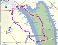
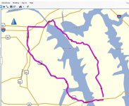
I'm getting different results here when I create a simple route using BaseCamp. I'll show you what happens here.

Start/end poins with three way points (circled). With my Zumo 395LM connected to BaseCamp:
with gps.JPG

Without a gps connected:
no gps.JPG

When creating a "route" BaseCamp follows the roads. There have been instances where a straight line connected the way points in BaseCamp. I would delete that and start a new route. When that occured, I would see a dialog box stating "Initializing..." Then, I'd get the expected results for planning a route.

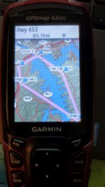
After sending to the 395LM and the 62stc (no guidance functionality), the new route works as expected for the 395LM; but, the 62stc is no good. Here is how it looks in the 62stc:
IMG_20230209_103121264.jpg

What I'm seeing in your screenshots, and with all those points, are tracks. There's no way to get route guidance with tracks, right?

I'm suspecting that once you have a "route" that the eTrex can navigate and provide guidance, you won't have a need to take so many notes while riding.
 
Top Bottom Back Refresh