What's new

+ Week Michigan Cross Country Cycle Trail MCCCT Ride

DJ_MI

Class Clown
Joined
Feb 7, 2022
Member Number
63
Posts
2,037
Location
SE MI
It was one year ago today that I completed the greatest adventure of my life.

I’ve been telling myself that I’ll post this ride report eventually but I never get around to it. I’ll just start it and keep adding to it as I get the time.

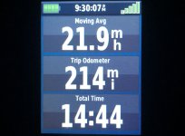
I got dropped off on October 1st and picked up on the 8th at 3:54PM. Exactly one year ago from right now.

Here’s the actual GPS track of my ride.
IMG_1635.jpeg


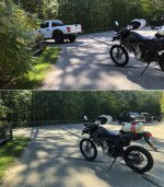
Here’s my wife driving away from dropping me off. I’m on my own now! I was nervous as shit.
IMG_1638.jpeg


Here’s the trailhead in Gladwin. I couldn’t believe I made it. Realistically I gave myself about a 50/50 chance I’d actually complete the ride.
IMG_1631.jpeg
IMG_1633.jpeg


And here’s my wife pulling in to get me! I rode to the freeway to save a little time.
IMG_1634.jpeg
 
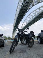
Not that far. About an hour by car and about two hours by KLX. :lol2

When are you going there next?

I've ridden out there a few times.
bluewaterbridge2-2021-07-31 15.27.15.jpg
Maybe some time in 2024. If not then, 2025 most likely. I'm planning a ride down to Daytona Bike Week in 2024. That'll be how I spend my 2024 PTO.
 
MCCCT: What Is It?

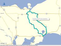
The MCCCT is roughly shaped like the letter "A" with two distinct sections; the "Arch" and the "Cross State Connector". The actual mileage for the Arch is more than 550 miles and the xState Connector is about 120 miles.

I don't know if it's true but I've heard that the Michigan Cross Country Cycle Trail is the longest marked continuous motorcycle trail in the world. It is comprised of many individual trails and routes. It passes through some of the greatest trails we have in the Lower Peninsula including: Atlanta, Beaver Creek, Little O, Big O, Gladwin, Grand Traverse, Hunt Creek, Kalkaska, Leetsville, Lincoln Hills, Little Manistee, Mio, Missaukee, Ogemaw, Rose City, The Meadows, Tomahawk, White Cloud & others. There's road connector sections where no trails are available so a plated bike is required.

The terrain varies a bit. You'll find sand, whoops, pine forests (lot of roots!), forested areas (clear cut with tons of limbs & debris), very rocky areas, and more sand and more whoops. Sand & whoops are unavoidable when riding in Michigan; they are seemingly everywhere and can sap energy like nothing else I've ever ridden. I've come to realize that there are many different types of sand. I wish I had some form of 'whoop counter' to keep track of how many there was. I crunched some numbers and my best guess is that I rode over approximately three trillion whoops on that trip. There were a lot of downed trees to deal with. Some sections I were so tight and twisty that I averaged 8MPH. The road connectors offered a nice break from the trails. I found myself at times hoping and wishing for a road section because I was so so exhausted from the trail. I could actually sit down for a bit, relax my arms and hands and get some airflow to cool me off. Though after a little bit on the road I'd find myself eager to get back into the woods. Much of the trail is very remote with some sections of the single track having grass and vegetation growing in the middle of the trail and no signs of recent tire impressions. That growth can easily hide hazards just waiting to break your bike or your foot. There isn't cell signal in many areas. I had no plan in the event I got injured which was very stupid of me. Just several months later I watched as my son broke his arm playing sports and I realized just how foolish my decision was. He handled it well; I would've been freaking out. Freaking out is not a solution to getting injured alone in the back country.

Navigation was tough for me. The signage wasn't very good. There was one stretch where someone had intentionally flipped a bunch of the signs around. Other sections like some of the logged areas had no signs. I had the DNR tracks loaded in my GPS and purchased the base map from VVMapping which was very helpful. I still got lost a lot.

All that being said; this is not a pleasure ride. I found one ride report from a couple of guys who traveled here from out of state and quit after a few days; they just didn't know what they were getting into. I rode a few miles of the MCCCT in '21 and got my bike stuck under some suspended dead-fall, tired myself out getting it unstuck and realized how unprepared I was.

I loved the idea of testing myself. Could I endure the struggle or would I buckle mentally? I had to find out! Please don't misinterpret this as me being boastful about my abilities, it's all relative. I'm not a tough guy, I'm not an outdoors man, I'm not even a very experienced rider... hell, I don't even like going out of town for work and staying in a nice hotel; I love my bed and my pillow. Many people here could do this ride no problem. But for me I knew I was going way outside of my comfort zone and that was the test I wanted. Having no idea where I was going to sleep or eat was a scary thought. I'd have no choice but to figure it out.
It is a long, unpredictable ride that would definitely test me mentally and physically. I'm not that smart and I'm not that fit so I knew it was going to be especially tough!

Here is what it looks like. I got this from the DNR's arcgis site I did a recce ride on the xState 6 weeks earlier and did NOT ride it on this trip.
MCCT_Overview.jpg


2022-10-01 14.29.18.jpg

Up next I plan to talk about some of the planning and preps for my ride.
 
Last edited:
I did get attacked by an animal on that trip! That’ll be part of the story for sure. :D
 
A LITTLE OF THE BACK STORY:

In the spring of 2021 my kid told me that he wanted to buy a dirt bike. "Find where you can ride it at and get back to me" was my response. He returned shortly later and showed me the Michigan DNR's Interactive Trail Map website. Sold! I was onboard and soon searching for my own bike. I settled on a KLX300; it seemed versatile enough for me to get some real use out of it. I had no idea just how much it would change my life. My son bought a TTR125 from a friend of mine and I got the KLX.

Here's my son riding the TTR after we picked it up:
2021-06-01 21.07.47.jpg


Here's our first trip up north to ride the trails. We were unprepared for the sand:
2021-07-10 10.36.26.jpg


It wasn't long after we started going up north that I first heard of the MCCCT. I wanted to do it. I started making my plans. Over the next 15 months I spent much of my free time planning & preparing. Making lists, studying maps, reading other ride reports. Researching weather history & how many hours of light I'd have. I'm a nerd so of course I made a spreadsheet to help with the planning; soon it turned into a whole workbook with many tabs of the information I was collecting. I made a packing list and weighed every item I took.

I naively set a start date for the end of the season in 2021. That is until I went up north and found a section of the MCCCT to ride and saw firsthand that tight and rugged single track was a lot different that the ORV trails we normally rode. I quickly realized that I'd never make it. I figured that I'd wake up on day three and my hands would be so numb and stiff that I wouldn't be able to continue safely. Later I realized that I would have gotten so hopelessly lost right from the start that I would have quit knowing that I had no chance of making it. I opted for a trip to the UP instead which worked out good. Most of the trails in the LP are pretty narrow, it's hard to learn to ride sand when a face full of tree trunk is waiting. In the UP though many of the county roads are extremely sandy but wide enough to not be as dangerous. It finally clicked for me; riding in the sand is very similar to driving a boat, you have to get up on plane and create some pressure underneath for more stability. Being loose on the bars and letting the front wheel wander is a bizarre feeling but helps hand fatigue. Riding through ruts is a lot like driving through the wake of another boat, gently climbing up and over it while using some gentle steering inputs to help keep it on course.

Here's the county road in the UP that I learned to ride sand on. Yeah, that's a tree full of bras! Some people call it "The 8th Wonder Of The World":
2021-10-18 14.13.02.jpg


I spent a quick minute admiring the tree and quickly moved along :hide:
Bra-Tree-Track.jpg


I knew that I needed to improve my riding skill and my physical conditioning so I set out to address both of those. I spent countless hours in a local parking lot working on slow speed maneuvers and improving my balance as well as my core strength. I learned how to hop over obstacles and do small "pivot turns" to turn the bike in tight spots or onto & over logs running parallel to the bike. I started going on progressively longer walks while using my GPS to help with my nav skills. We went up north and rode trails as often as possible. I lost around 15lbs and conditioned my riding muscles. I spent countless hours working the GPS tracks that I'd follow. I added waypoints with information like "Gas 1.5m EAST" or "Motel 6m NORTH". Those turned out to be enormously helpful. There's way too many points (~10,000) for routing so what I had was a purple line on the screen as confirmation that I was still on the right trail. Easier said than done!

Here's an example of one kind of whoops that you'll find on the trails. I never knew there could be so many different types of whoops. I'd list them all but I'd sound like the shrimp guy in Forrest Gump. Big whoops, little whoops, sand whoops, berm whoops, macro whoops, micro whoops...:
2022-06-23 09.35.14.jpg
2022-06-23 09.35.28.jpg


Up next, the gear and final preps!
 
Nice ride report so far! Thanks for sharing.

Have you heard of this club?
GLDS
Great bunch of guys that ride throughout upper portions of the lower MI peninsula. You'll get a lot of seat time in various trail types and conditions..of course sand and whoops will be part of it. Club President owns VV Mapping so we get all the good stuff/info when it comes to DS ride routes...
Thank you very much. Thanks for reading it!

Yeah, for sure I've heard of GLDS. I didn't know that Jeramey is the club president. "2TrakR" was a name I came across very often as I scoured all the forums for information and ride reports about the MCCCT. I've never met him but he's a legend as far as I'm concerned. The VVM map was worth every penny. It proved to be much better than the DNR's data.

Like everyone else who enjoys riding our trails, I've made my peace with sand and whoops. :D
 
THE PREPS & GEAR:

I refined my lists, collected the stuff that I didn't have, and worked on prepping the bike. I was only able to take maybe 10% of the items I had listed. I spent a lot of time being as selective as possible. I'm the kind of guy who generally packs everything including the kitchen sink for a trip so it was tough to prune out so much stuff!

I took all the body work off of my bike to clean and inspect it thoroughly. I found a few wires with some chaffing that I cleaned up. And did the obvious routine maintenance.
MCCCT-Bike-Prep.jpg


I weighed everything and went to great lengths to save as much space and weight as possible. Though a few ounces here and there probably didn't realistically make a big difference I knew that when I was exhausted that it'd give me a boost knowing that I was carrying as little as possible. This is for the rear axle adjuster lock nut:
MCCCT-Prep-12mm-2.jpg


Here's my spare parts kit. A broken shifter could end the ride so I got this cheap, lightweight replacement just in case. I brought some safety wire, electrical wire, a spare spark plug, a few extra nuts and bolts, and a chain master link.
MCCCT-Spare-Parts-Loose.jpg


And the spares all bundled up tight:
MCCCT-Spare-Parts-Packed.jpg


I carried my tire repair kit in a fender bag. I threw my spare key in there just in case. If I ever do this ride again I'm going to run mousse inserts in the tires. A puncture was my biggest mechanical worry.
MCCCT-Fender-Bag.jpg


I carried a very spartan tool kit:

MCCCT-Tools.jpg


I used endless cam buckle straps to secure the dry bags with my sleeping kit on top of the tail. In retrospect I should have brought a few extras because I wound up strapping my jacket and hydration pack on the tail when they got to be too hot and heavy to wear.
MCCCT-Cam-Buckle-Loop.jpg


Up next; testing it out and some recce rides!
 
RECCE TEST RIDE #1; The Cross State Connector:

I had a tentative leave date of mid-September. I was getting nervious; I'd made a lot of progress but I knew that I still wasn't ready. I'd never run the trail distance in one day that was going to be required to stay on schedule. I'd never ridden with luggage and I still had never camped off of a motorcycle. My wife suggested that I go for a trial run. That's a great idea!

My plan was to run the xState and then get up early the next morning go ride for a few hours in the famous St. Helen sand. If I woke up and couldn't ride any more I had no business attemping the long ride. TEST #1... GO!

Here's the bike packed up and ready to go:
2022-08-19 07.08.25.jpg


I rode a few miles from camp to the east start of the xState trail snapped this picture... aaaand I'm off!
2022-08-19 07.21.31-2.jpg


Nearly half a mile down the trail I glanced down at my GPS... where's my purple line!?! I was on the wrong trail... :fpalm I backtracked to where I started and found the ACTUAL start of the xState. With 0 miles completed I managed my first nav error. It certainly wouldn't be the last!
2022-08-19 07.21.31-22.jpg


Here's the actual start of the Cross State Connector:
2022-08-19 07.27.50.jpg


Somewhere around the halfway point and my bike started shifting weird. Not long later I got to a section that was marked as "CLOSED". I got off the bike to check the maps and figure out where the redirect was. Yeah, that's sweat on the gas tank and saddle bag.
2022-08-19 10.48.43.jpg


I quickly figured out my shifting problem. This was jammed into the chain guide. How I didn't know that I'd been dragging this I have no idea but I'm glad it fixed my problem!
2022-08-19 10.54.44.jpg


Mid afternoon it was getting really dark in the woods. I actually turned my highbeam on to help see. When I emerged from the trees I could see why. The storm was pretty intense but didn't last long. I hunkered down in a little wooded valley with my rain gear and waited out the worst part. I was ready for a break anyhow.
2022-08-19 14.33.12.jpg

2022-08-19 15.11.07.jpg


I love these pine sections of trail. The ground is generally firmer but you have to be mindful because the pine roots seem to grow closer to the surface and are as hard as bone.
2022-08-19 16.36.54.jpg


I've learned to be generous with my calculations. When I'm trying to figure out how far until the next fuel stop or how long until the end I like to add a little mileage as a safety buffer. I don't remember the exact numbers but I was figuring that the end was somewhere around 120 miles. I was exhausted; I'd already ridden at least twice as many trail miles that I've ever done in one day before. I really didn't know how much further I had but I finally made it! I propped my phone up on some twigs and took this great picture of me at the west end of the xState.
2022-08-19 18.45.01.jpg
 
PART 2 - RECCE TEST RIDE #1; The Cross State Connector:

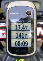
The xState wound up being 141 miles total including nav errors and leaving the trail for fuel once. Those last 21 miles were really tough since I was expecting... hoping... to have already been at the end.
2022-08-19 18.45.42.jpg

I rode up US-131 to Fife Lake to refuel. I was dreaming of a nice hot plate of spaghetti and a chocolate shake. I let myself get too hungry. I was shaky and tired. As I was pumping the gas into the bike I somehow managed to spray the fuel all over myself, my bike and my hydration pack that was hanging on the handlebar. Ooof! I skipped the sitdown dinner and bought a bunch of junk from the gas station.

The return ride to camp was uneventful. The gasoline smell was slowly dissapating in the wind! Here's my total time and miles:
2022-08-19 21.30.08.jpg

And my GPS tracks from the entire ride:
xState-Track-Map.jpg


I got up the next morning and rode around in the sand for a while. I got a slow start but as soon as the blood was pumping I was having fun! Test #1: PASSED!

My plan initially was to take ALL of my gear and camp on the west end of the xState. I just couldn't get it all together in time and I was planning a trip to the UP in September so TEST #2: Camping Off The Bike would have to take place on that trip. My tentative leave date for the MCCCT was September 24th. I was feeling much more confident after my successful xState ride!
 
Last edited:
#1 tip for long adventure trips.... take each day as it comes. Don't try to stick to a certain number of miles each day and make a bunch of overnight stops you planned 6 months earlier.

Ride each day until you're tired and then stop. We normally start looking ahead at camp sites around 2-3 in the afternoon.

When I lay out tracks, I put in as many campsites as I can about 10 miles either side of the track. I pre-research each one before I waypoint it. Much easier to do at home on the computer, rather than on the fly. Also, a lot of times you have little to no cell service

Mid day comes and it's easy to look ahead and pick a campsite as your target for the day.

Another trick I use is to cut my tracks into 100 mile (or 200 for really long trips) segments, and alternate colors every 100 mile segment. Makes estimating distances really easy. Use what ever two colors show up best for you on your GPS.

Highjack off....:shog
 
RECCE TEST RIDE #2; CAMPING OFF THE BIKE IN THE UP:

I still hadn't camped off of my bike or run it with the full load of gear that I'd need for the MCCCT. I planned a trip to the UP in September to test my gear and try camping off the bike.

I made the drive up to the Upper Peninsula to meet some friends in Manistique. The UP is so much different than the LP and it's always really nice to be up there.

We rode J-Route (aka Haywire) from Lake Michigan north to Lake Superior. The trail is decommissioned rail line so it's pretty fast and rolling with some great views. The next day we rode down to the tip of the Manistique Peninsula and met the owner of a fishery. He was a fascinating guy and spent a lot of time with us. The people of the UP are almost universally friendly and accommodating and he was no exception.

Here's a few pictures from our J Route ride:
2022-09-11 12.03.55.jpg

2022-09-11JRouteHaywire Ride.jpg

I said my farewells and split off so I could try hauling my full load of gear and camping from my bike. I wound up at a small motel in Epoufette.

During the day I rode A-Route out to the Manistique Lakes. On the way back I was scouting out spots to camp. I ran across the Garnet Lake Campground; I'd stayed there the previous year and it was familiar and nice. The only problem was that it was pretty far from the motel and I wouldn't be able to make it back before dark. I dropped a way point and made my way back to A-Route. I found a small offshoot trail and explored back in there. It was marked on the map as a DNR Forest Road that was open. It was very overgrown and didn't look like anyone had been back there in quite a while. I followed it back to a small clearing and it seemed like a great spot. I dropped a way point and rode back to the motel.

I packed up all my gear and I let the woman at the motel that I wouldn't be back until the morning. I hit the general store across the street for some food and drinks and rode back out to the way point in the forest.

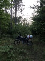
Here's my spot:
2022-09-13 20.08.17.jpg

It was getting dark quick and the coyotes were howling. An owl landed on a nearby tree, standing watch as I finished setting up my tent.
2022-09-13 20.34.34.jpg

2022-09-13 20.27.00.jpg


I had a feeling the owl was trying to determine if I was brave or stupid. The darker it got the more nervous I was getting. It'd soon be too dark to ride through the forest to get back to the trail. Was I brave enough? Nope! I tore down camp in record time and packed it up... Garnet Lake Campground here I come!

It was a pretty long ride down the dark, sandy trails. I had a few big moments but kept it upright:
2022-09-13 21.13.18.jpg


I finally made it to the campground and set up camp:
2022-09-13 22.06.56.jpg


It'd been a long day and I slept like a baby! I know it's kind of stupid in this crowd, but I really felt a sense of pride in the morning as I admired my camp. I did it! I camped off my bike for the first time.
2022-09-14 07.50.552.jpg


I packed everything up and headed back to the motel.

Test #2 CAMP OFF THE BIKE: PASSED!

I really felt like I was ready for an attempt at the MCCCT. I was about as prepared as I was going to get. If things went as planned I'd start the MCCCT in 11 days.
 
#1 tip for long adventure trips.... take each day as it comes. Don't try to stick to a certain number of miles each day and make a bunch of overnight stops you planned 6 months earlier.

Ride each day until you're tired and then stop. We normally start looking ahead at camp sites around 2-3 in the afternoon.

When I lay out tracks, I put in as many campsites as I can about 10 miles either side of the track. I pre-research each one before I waypoint it. Much easier to do at home on the computer, rather than on the fly. Also, a lot of times you have little to no cell service

Mid day comes and it's easy to look ahead and pick a campsite as your target for the day.

Another trick I use is to cut my tracks into 100 mile (or 200 for really long trips) segments, and alternate colors every 100 mile segment. Makes estimating distances really easy. Use what ever two colors show up best for you on your GPS.

Highjack off....:shog

Thanks Bob! Not a hijack at all! That's all sound advice and I'm happy to report that I actually did try to do some of those things.

I knew for sure that there was no way I could set a destination goal for each day but I knew that I had 9 days and that the track itself was 542 miles. That alone is 60 trail miles/day. Past experience showed the DNR tracks understate miles by maybe 8%. Then add miles for off trail to get gas, food and to sleep and I really had no way of knowing how far I'd need to go daily to stay on schedule. I'd never ridden anywhere close to that many trail miles in a day so the xState test was reassuring to know I could at least do it for one day.

Even though my wife didn't understand, she was understanding about how much this meant to me. She was kind enough to tell me that if I needed more time it was okay. So I had a little buffer if needed but the idea of going much longer than 9 days didn't seem realistic.

I broke the track into 14 sectors with alternating colors just like you suggested.
MCCCT-BaseCamp-MAP.jpg


Here's my breakdown of the 14 sectors. The distance for each and how many track points were in it. The pnts/mile was me trying to get some idea of how twisty each sector was; it turned out to be somewhat helpful. The right columns are calcs for how much I'd done and still had to do. It was actually kind of cool to refer to that; it was a moral boost when I felt like I wasn't making decent progress. I dropped a waypoint right at the 50% point and got a picture there which was pretty cool.
MCCCT-Sectors-Sheet.png


Here's a couple of the preprogrammed waypoints like you'd suggested. The "MCT09" was to keep them organized in BaseCamp to show which sector it was in. I put a lot of hours into these tracks and I could have put in a lot more! I focused on gas stations. I didn't have as many sleeping options as I'd have liked. Like you said, it's no fun trying to find where to stay on my phone with shitty cell signal but I did a lot of that. :lol2
MCCCT-WayPointers.jpg
 
THE FINAL COUNTDOWN(S):

I got back from the UP on September 14th feeling pretty good about my chances of completing the MCCCT. We set Saturday September 24th was the date that my wife would drop me off on the west end of the arch.
Calandar-Sept24.jpg


I kept working on my preps, fine tuning my GPS tracks. I updated my last will and testament, made sure my life insurance was paid up and I deleted my browser history. We spent a lot of time in the garage tweaking and prepping the bike and gear:
2022-09-17 20.10.31.jpg


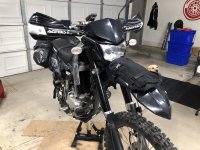
I cleaned and inspected the bike and realized that I was crushing some wires under the rear cowl from cinching the luggage down so tight. I fixed the wires and put the bolts for the original storage pouch back in to help bear the load.
MCCCT-Saddle-Bags-Mount.jpg


I was frustrated when the leave got scrubbed due to problems at work. I pushed it back a week and wrote in on the calendar with permanent marker... October 1st I was going!
Calandar-Oct1.jpg


It actually worked out because the week of the 24th turned out to be pretty rainy. I'd have a little less daylight and a few more leaves on the ground but turned out that I only had one of day rain.

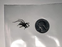
It seemed like everything was trying to keep me from leaving. The week leading up to my departure I kept feeling paranoid that I was getting sick but I wasn't. One day I was riding home from work and I felt a little pain on my arm. I kept going and it started to feel like a burning sensation. I stopped to see if maybe I caught someone's discarded cigarette on my sleeve; nope. I was really close to home and now my arm was on fire! I pulled into my driveway and ripped my riding jacket off and this is what fell out:
2022-09-27 19.59.03.jpg

I was convinced that I was going to go anaphylactic or experience some rare form of arm paralysis that would keep me from making my leave date. Ultimately nothing did stop me.

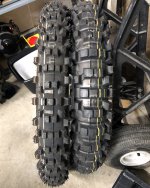
I swapped on fresh Dunlop D952 tires front and rear with IRC Extra HD tubes:
2022-09-23 20.34.50.jpg 2022-09-29 23.56.58.jpg

On Friday night I spent the evening packing up everything up and getting ready to leave in the morning. I was extremely excited but also tremendously nervous!
2022-10-01 00.41.58.jpg


I wanted to leave first thing in the morning but I stayed up way too late. My last picture was from 1:44AM but I think I was up until about 3AM:
2022-10-01 01.44.47.jpg


Up next: Finally on the trail!
 
DAY ONE: THE START, FINALLY!

My plan was to leave first thing in the morning on Saturday October 1st. I couldn't fall asleep the night before and slept in. By the time double and triple checked my gear after getting it loaded we finally hit the road at 10:43AM. We stopped to get some food and I snapped this pic of my bike in the truck.
2022-10-01 11.06.47.jpg


I was driving since my wife had to drive home by herself so she could rest before driving. We were maybe a half hour out from the drop off and I was getting some serious butterflies in my stomach. I had my arm on the window sill and rested my head on my hand; that's when I really realized my excited and nervous I was... I could feel my pulse in my temple and my heart was pounding! My wife is a champ and I'm so grateful for her support in making this adventure happen. Knowing I'd ramble on with my typical long-winded answer, she asked me a question about the ride. It worked and next thing you know we were nearly there. Thanks!
2022-10-01 14.29.18_2.jpg

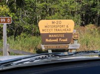
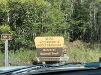
We rolled into the M-20 Motorsport & MCCCT Trailhead in the Manistee National Forest at about 2:30PM. My memory was that I unloaded the bike, we said our goodbyes and she drove off. Looking through the pictures I realize that she was there for about 45 minutes. I'm pretty sure I was stalling...
2022-10-01 15.08.57.jpg

2022-10-01 15.15.04.jpg


My wife rolled out and I was officially on my own. I missed her already and felt kind of lonely... I needed to stop thinking and get moving.
2022-10-01 15.18.10-1-2-2.jpg

After all the planning and prepping I finally rolled out and officially started on the MCCCT! I was feeling good once I got moving, the nervousness was gone and I was just excited about the adventure. The extra weight on the tail of the bike.

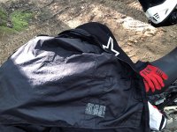
About ten miles in I was sweating a ton and was super hot! I stopped for a break and realized why... I forgot to take the liner out of my riding jacket! I was basically wearing a garbage bag under my jacket.
2022-10-01 16.25.48.jpg
2022-10-01 16.33.20.jpg


The White Cloud trail is pretty typical of Michigan trails.
2022-10-01 16.33.18.jpg


Good thing I brought my own maps!
2022-10-01 16.36.25.jpg


Here's what my load looked like on the back. On the second day I strapped the roll further back on the tail which really helped with the handling and gave me more room to move around on the seat. I'd never ridden with knee protectors before but I thought maybe it'd be a good idea to get some. I compromised and bought these cheap ones from Home Depot. It turns out that I'm really glad that I brought them!
2022-10-01 17.07.17.jpg
 
Top Bottom Back Refresh