What's new

+ Week Michigan Cross Country Cycle Trail MCCCT Ride

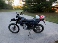
DAY ONE: PART 2

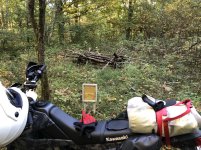
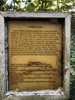
I wandered off the trail to find the Star Lake Lookout Tower. I nav'd to the way point but couldn't find it. I circled around a little and finally found it... or what was left of it.
2022-10-01 18.04.03.jpg


I underestimated how much light you lose in the woods. This was about 40 minutes before sunset:
2022-10-01 18.46.01.jpg


I wish I would have taken a picture of the group of riders that I met along the way. It was three generations of trail riders. They were super friendly and the patriarch of the group gave me his cell phone number and told me not to hesitate to call him if I ran into any trouble. He checked in on me periodically over the week. :thumb

I finally decided to stop and figure out where I was going to eat and sleep. I probably should've thought of that a little earlier:
2022-10-01 19.25.05.jpg


I dropped some way points at a road crossing a ways up the trail so that was where I'd hop off for the night. I rode the last section of trail nearly in the dark:
2022-10-01 19.48.50.jpg


I stopped at one motel but they said they only had cabins left and wanted more than I was willing to spend. I went to the restaurant across the street and ate like a king. I forgot to take a picture so here's one from maps:
2022-10-01 EmersonLakeInn.jpg


Next stop was to check the Lazy Days Motel and if that didn't work there was a campground past that where I'd stay. This motel only had cabins available but for half the price of the last place; SOLD! I checked in with my wife and let her know I was in for the night.
2022-10-01 21.59.54.jpg

2022-10-01 22.01.15.jpg


I liked the door lock!
2022-10-02 09.12.08.jpg


Here's my tracks from that day. The Cyan line is the trail and the Red line is my ride into Branch Township for the night.
2022-10-01-Tracks.jpg


And here's my overall progress. I knocked out 53.6 trail miles and covered 71.9 total miles.
2022-10-01-Overall-Progress.jpg


Overall I was feeling pretty good. It turned out that my cabin neighbor is a trail rider so we talked for quite a while before I turned in. I set my alarm and then reviewed my tracks for the next day until I fell asleep. I didn't get much reviewing done before I was sleeping.
 
DAY TWO:

Day 1 was really a bonus day. Day 2 though was down to business. I had a lot of miles to cover and a limited amount of time to do it in. I got up before dawn and started to pack up all of my gear. I really underestimated how long it would take to get everything carefully stowed away in it's proper place and get the rolls packed up watertight and cinched onto the tail of the KLX. I fiddled with everything for at least an hour and a half that first morning. I'd have to get up earlier... that was going to be a tough task as the days wore on.

2022-10-02 07.57.32.jpg
2022-10-02 09.24.25.JPG


I stopped for gas on my way back to the waypoint I dropped when I hopped off the trail the evening before. I was back on Sector2 a little after 10AM for what was going to be a pretty tough day.
2022-10-02 10.11.17.jpg


On some of the single track trails there are gates or posts to keep wider ORVs out. I like how they used trees on this trail.
2022-10-02 11.03.35.jpg


There was a lot of dead fall on the whole ride. This one was fresh and there wasn't a lot of options. I found one track from someone who'd gone around it and I followed their track the best I could. I don't remember seeing anyone else all morning.
2022-10-02 11.24.51.jpg


The variety is nice; I really enjoy the pine forest areas.
2022-10-02 13.46.08.jpg
 
DAY TWO: PART 2

By mid-afternoon I was getting close to Wolf Lake and the traffic picked up. The sand here was pretty bad and was tiring me out. It seemed like it was probably 90°. I didn't want to shed my jacket and lose the protection it provided. Looking at the records it didn't break 70° that day.
2022-10-02 14.42.53.jpg
2022-10-02 14.43.41.jpg


I was about 20 miles into Sector3 and needed fuel for both the bike and myself so I hopped off the trail and rode down to the Wolf Lake Store. I was definitely feeling the sand. I greeted a man who was leaving the store as I was walking in. "How are you today?" I asked. "Good" he replied, "How are you?". "Good" I said. He certainly wasn't trying to be rude but he chuckled a little bit. I wasn't fooling anyone; I'm sure I looked like a haggard mess I'm sure.

I got pretty good at eating off of my bike. I'd line everything up on my seat and clip the plastic bag to my luggage for the trash.
2022-10-02 15.09.14.jpg


I was back on the trail for the final push of the day. Here's a good example of wide the variety of trails on the MCCCT can be. This is section was a troughed out sandy single track with a lot of overgrowth whipping me in the face. Honestly, getting whipped in the face with pine branches was a welcome change from worrying about oncoming traffic in the deep sand from earlier!
2022-10-02 16.02.06.jpg
2022-10-02 16.34.41.jpg


I stopped for a little nav break here. I was trying to decide if I should keep going or hit a road and try to find somewhere to stay for the night. I should've hopped off for the day; I was tired but I decided to keep going.
2022-10-02 16.57.59-1.jpg
2022-10-02 16.58.30.jpg
2022-10-02 17.06.38.jpg
2022-10-02 17.19.57-1.jpg
 
DAY TWO: PART 3
About an hour later on a section of trail that wasn't even that challenging I somehow lost control and was heading for a tree. I mashed on the rear brake and stopped just in time to lean the bike against the tree instead of using the kickstand. I took a quick break and consulted the GPS for the nearest cross road that I could hop off onto. Caberfae was less than 10 miles to the north so I'd head up that way. I started that morning in Sector2 and was now about 10 miles into Sector4. I was tired and hungry but I felt like I'd made pretty good progress.
2022-10-02 17.53.21.jpg
2022-10-02 17.53.36.jpg


I rode north on the roads that jogged back and forth and I saw this place. I wasn't exactly sure what it was but it looked like they could have food. I was in luck! They had great food. I searched around on my phone trying to figure out where I could stay for the night. There was a few USFS campgrounds not far away and a motel that wasn't answering their phone maybe 15 miles to the west. I asked the waitress if she knew of anywhere to stay and she told me that they have cabins for rent right there on the property. Wow, my luck was pretty good... until she told me the price. She was very nice to me and offered to call the owner and see if she'd be willing to cut me a deal. She returned shortly later with a price that was about half of what she said intiially but about twice what I'd paid the night before. It was getting cold out, now I was full and tired and she'd been so helpful... sold! I had no idea what the cabins looked like but I was expecting something a little nicer than the night before but probably not too fancy. I paid my tab and also for the rental and she told me how to find the place from the lodge.
2022-10-02 18.52.54.jpg
2022-10-02 18.52.57.jpg


I rode down the drive and, wow, the cabins were amazing... quite a step up from the night before!
2022-10-02 20.22.24.jpg
2022-10-02 20.23.31.jpg
2022-10-02 20.27.10 - Copy.jpg
2022-10-02 22.40.47.jpg
2022-10-02 22.43.08.jpg


Total miles was 172.9 so I was about 22% of the way done. I didn't really know any of the exact figures at the time but I was feeling pretty good about my progress. That wouldn't last...
2022-10-02 Progress.jpg
 
Dang...I would have liked every post but I live in the sticks where data takes longer than riding. You and klaviators posts freeze my phone from pics! Ha..I really missed out on UP rides. But I never took any time off when I lived up there. But I rode every day.
 
Great report. Quite the adventure for sure. All that sand would have me off on the roads within a few seconds of sighting the first bit.
I've taken several riding schoolshaving come to adventure riding from sport bikes and touring bikes. Jimmy Lewis taught us balance and control and steering with our feet. Still spending all day on a big bike without a load was a workout. Only once I spent the better part of a day riding deep sand on the 990R with worn Skorpion AT's and a full travel/camping load. Thankfully back then I was in condition and had enough practice to relax into the riding. I didn't ride fast, but I didn't tip over nor work too hard. If I lived where all the riding away from tarmac was sand I'd have a small bike for sure.

Enjoying the report.
 
Great report. Quite the adventure for sure. All that sand would have me off on the roads within a few seconds of sighting the first bit.
Thank you very much! Yeah, the sand was a steep learning curve for me and I really struggled with it for a while. It's everywhere here in MI so I didn't have any choice but to learn to deal with it. The turning point for me was riding in the UP with wide county roads where I could get some speed and experiment a little bit without worrying about trees just a few feet away.

I've taken several riding schoolshaving come to adventure riding from sport bikes and touring bikes. Jimmy Lewis taught us balance and control and steering with our feet. Still spending all day on a big bike without a load was a workout. Only once I spent the better part of a day riding deep sand on the 990R with worn Skorpion AT's and a full travel/camping load. Thankfully back then I was in condition and had enough practice to relax into the riding. I didn't ride fast, but I didn't tip over nor work too hard.
That must have been an awesome and helpful experience! I'd love to get some instruction from a pro rider some day.

My full load on my bike was about 26lbs. Adding ~125+lbs with a bigger bike wouldn't be something I'd even be willing to try! After riding your 990 in the sand you'd do just fine on a little bike like mine. 👍

If I lived where all the riding away from tarmac was sand I'd have a small bike for sure.
I can only imagine how difficult it would be to ride a big bike on the sandy trails. There's some spots along the MCCCT where a big bike just wouldn't be possible for mere mortals.
 
DAY THREE: PART 1

I slept like a champ in my luxo-cabin and got to work packing the bike up. It was the coldest morning so far at right about 30°. The KLX had a layer of frost on it. I warmed the bike as I packed and then wiped it all down.
2022-10-03 07.21.57.jpg

2022-10-03 07.37.28.jpg

2022-10-03 08-30-25IMG_0003.JPG
2022-10-03 08-50-06IMG_0005.JPG

I made my way back to the way point of where I left the trail along Sector4 and started riding. I'd heard before that there was a marker out along the MCCCT somewhere about two friends who met while riding the trail. The two guys go by "YoungTed" (AKA Inca) and "KTM Mike". Ted would have been 75 years old when he was riding the MCCCT solo in 2003. Ted and Mike later posted a RR on dirtrider.net in 2008 when they rode the MCCCT again for Ted's 80th birthday! If anyone is out that way and wants to see it for themselves you can find it here: (N 44°07.465' W 085°40.532').
2022-10-03 09.15.49.jpg
2022-10-03 09.16.01.jpg


It was tough going for the rest of the morning. My mind was starting to play tricks on me and I felt like I was riding in a big spiral. I also kept feeling like I'd seen this portion of trail the day before. I was overheating and feeling frustrated with my lack of progress. At this rate I'd never make it to the end. I stopped for for a break and saw this on my saddle bags; at first I thought my bike was leaking something. Then I realized it was sweat that was dripping out of my helmet. Looking back at the GPS track I was averaging about 8.4MPH for the previous two hours. It was a very tight section of trail without much airflow to keep me cool.
2022-10-03 11.37.42.jpg
 
DAY THREE: PART 2
I didn't have time to stop and take pictures of every notable section of the trail, there was a lot of them! This hill climb had too many features to not take a few pictures. It was a decently steep climb but near the top there was this branch that got wedged into some trees and was pointing right onto the trail like a spear.
2022-10-03 11.43.49.jpg


This is an example of how being able to loft the front of the bike is an important skill. Almost all the way to the top of this hill was a root step up. It was too tall to just slam the front tire into so being able to lift the front end to clear it was helpful.
2022-10-03 11-43-56IMG_0011.JPG


Getting a puncture was one of my biggest concerns. I had tools and a tube but I really didn't want to use them. Looking back I wish I would have run mousse inserts and not been so worried the whole time. Keeping a close eye on the trail for hazards was a continuous task. This definitely could have been a problem:
2022-10-03 11.45.13.jpg


It was along this stretch also that I lost track of how far I'd gone and I missed my waypoint for a fuel stop. I only realized it when my fuel light came on. Oops! I stopped to find where the nearest gas station was and it was quite a ways away. It was going to be close...

The KLX has a 2 gallon tank which means I had about 0.1 gallons left... I was about 5 miles away from walking. I already felt like I was falling behind so I'm grateful that I didn't run out of fuel. I wasn't pleased with myself for missing the planned fuel stop which would have been 4 miles round trip off the trail. Instead I went over 20 miles. I'll have to pay better attention.
2022-10-03 12.44.45-1.jpg

While at the gas station I ate lunch in the parking lot and drank as much as I could handle. It was only about 1PM but I remember sitting there eating and drinking and really feeling discouraged; I felt like I wasn't making very good progress, I was tired, and the extra time I'd cost myself for fuel wasn't helping. I knew this ride was going to be tough, both mentally and physically, and this was the first time since I started that I was having doubts about whether or not I could make it to the end. I was really dragging as I threw my leg over the luggage and headed back to the trail.

Just by chance where I'd left the trail for fuel was right about where it started to open up. I only covered 20 trail miles in the first three hours of the day; over the next hour I made it almost 12 trail miles. That really lifted my spirits and I was feeling more optimistic again. I got to the end of Sector4 and moved on to Sector5.


Here's a nice overlook of the Manistee River in Greenwood Township:
2022-10-03 14-57-44IMG_0015.JPG


Sector5 was pretty easy sailing. There's no trails in this area so the MCCCT follows roads for a while. I was happy to have a little break from the trail, get some airflow to cool me off and feel like I was making some good distance. The sector ends at the west end of the Cross State Connector which was the recce ride I did just a couple of months earlier. It was neat to stop and get a picture on the same spot that I did in August.
2022-10-03 15.45.39.jpg

2022-10-03 17.52.52.jpg
 
DAY THREE: PART 3
I stopped in Fife Lake for fuel and food at about 4:30PM. I ate in the parking lot while I looked at the maps to see how much further I thought I could make it. I was feeling pretty good on these faster sections and wanted to keep making progress. I had no end point in mind and didn't have any idea where I was going to sleep. I'd figure that out later. I got back onto Sector6 which alternated between fast, easy trails and dirt roads. I made good time and averaged 22MPH over the next 1.5 hours and covered 35 more miles, completed Sector6 and started on Sector7.
2022-10-03 17.54.23.jpg

2022-10-03 18.10.32.jpg

2022-10-03 18.10.40-1.jpg

2022-10-03 18.15.46.jpg


By about 7PM the temp was dropping quickly and I was losing light. I'd just crossed US-131 and Mancelona was about 11 miles north. My maps showed that there was two motels up there so I dropped a waypoint where I left the trail and headed north.
2022-10-03 18.58.10.jpg

2022-10-03 19-09-18IMG_0018.JPG


There was a motel on 131 that wasn't on the map but no one was in the office and no one was answering the phone. I kept going north into town. The first motel looked a little sketchy. I found the office and knocked on the door; a guy answered in his underwear and it was really getting weird now. He told me that he didn't work there and the motel had been converted to short stay apartments; the office was now his room they just never took the sign down. I thanked him and backed away slowly before speeding away on my bike. I went to the other motel only to find that there was no motel sign and it looked equally creepy to the first one. I wasn't too impressed with Mancelona so far. I bought some gas and checked the maps. There wasn't any other motels within a reasonable distance so I decided to go back to where I left the trail and camp there. It was going to be a cold night and I wasn't thrilled about it but I was out of options so it'd have to do. On my way back south I noticed a campground off of US-131. I swung in there and headed to the office. No one was around so I called the number on the door. The woman who answered was very friendly and she asked if I wanted a cabin or a campsite. Another cabin sounded great! I was really getting lucky with my sleeping accommodations. She told me to make myself at home in cabin #3 right across from the office and she'd come up in a little while and we could settle up.
2022-10-03 20.10.19.jpg

2022-10-03 20.25.10.jpg


I unloaded my gear and soon Tammy stopped by and I paid her for the cabin. She asked what I was doing riding out there and I explained the best I could. She was super accommodating and even got me extra blankets and made sure I was all set. I rode a few miles down US131 to a gas station and bought some food and drinks for dinner.
2022-10-03 22.14.27.jpg


On day 3 I covered Sectors 4,5,6,7 and rode 103 trail miles & 158 miles total. It was a tough day. The ups and downs of the trail could be tough. Sometimes I felt like I would never make it and other times I thought I was going to finish so far ahead of schedule that I was contemplating riding back up to the west end of the Cross State Connector and re-riding what I road in August backward. Or maybe instead of calling my wife to pick me up at the finish I'd just ride downstate and surprise her by showing up at home. Those grandiose thoughts never lasted long when the next section of tough trail appeared in front of me and the riding slowed to a crawl. However it played out I was grateful for the experience so far and was so happy to actually be out there trying to get it done.

Screenshot 2023-11-22 16.24.06.jpg
 
DAY FOUR: GOOD PROGRESS & BAD DECISIONS

It was another slow morning getting myself and then my bike in gear. I was happy that it was a little over 50° so I wasn't freezing like the morning before. I got everything packed up and rode down US-131 back toward the trail. I stopped to top off with fuel and eat breakfast in another parking lot. I was back on the trail just before 10AM to resume Sector7.

2022-10-04 08.13.46.jpg

2022-10-04 09.35.49.jpg


Here's a couple of pictures of where the MCCCT passes through the Leetsville Trail network.
2022-10-04 10.42.55.jpg

2022-10-04 11.04.51.jpg


11:30AM: I hopped off for a short ride over to Starvation Lake for gas. This dog was checking me out:
2022-10-04 11.26.48 IMG_0775.JPG

2022-10-04 11.27.04 IMG_0776.JPG


12:30PM: Crossed the 45th Parallel
2022-10-04 12.23.55.jpg


1:12PM: I'm not sure what's going on here but if anyone is looking for a vintage snowmobile I know a place!
2022-10-04 13.12.09.jpg


Way up on that hill is the halfway point!
2022-10-04 13.30.31.jpg
 
DAY FOUR: Part 2

1:44PM: Along the Tomahawk to Kalkaska MCCCT Motorcycle Trail I reached the halfway point!
2022-10-04 13.36.36.jpg
2022-10-04 13.44.06.jpg


As the trail climbed up and over this big hill there was a lot of these in this area. I'm glad I fitted the hand guards.
2022-10-04 13.49.02-1.jpg

2022-10-04 13.54.52.jpg


1:54PM: The trail wound through this wooded area that I nicknamed "The Valley Of The Downed Trees". I'm not sure if this was caused by a tornado or what but the entire area had a ton of trees down. The next 2.5 miles was slow going since many of the trees were cut just wide enough to fit between without a lot of extra room. I didn't want to hook a peg on a log!
2022-10-04 14.04.45.jpg
2022-10-04 14.08.01.jpg
2022-10-04 14.08.12.jpg
2022-10-04 14.08.23.jpg
2022-10-04 14.10.37.jpg
 
DAY FOUR: Part 3

2:30PM: This was my first really bad decision of the day. This log was suspended over the trail. There was no way I could go over it in the middle and on the right side there was a couple of logs right where my front tire would land if I crossed it there. On the left side was a bunch of smaller logs running parallel to the trail and debris but also some sapplings and newer growth. I decided to ram my way over the left side and plowed into the growth and onto all the debris on the ground. I'm really lucky I didn't hurt myself or the bike with that foolish manuever. A broken ankle or punctured radiator would have ended my trip right there... I definitely should've have found a way around.
2022-10-04 14.30.30.jpg
2022-10-04 14.36.02.jpg
2022-10-04 14.37.01.jpg
2022-10-04 14.37.13.jpg


3:22PM: I passed through the Tomahawk Motorcycle Trail parking lot. The Tomahawk MC trail is an expansive and challenging network of trails. Other than passing through I've never ridden here but it's pretty famous among trail riders in Michigan.
2022-10-04 15.22.47.jpg
 
DAY FOUR: Part 4

4:30PM: Later in the afternoon I made my second terrible decision of the day. The trail popped out onto a small gravel forest road and I lost the track. You can see here that I went back and forth a few times trying to figure out where to go.
2022-10-04 16.32.00-MudHole.png


I spotted the sign on the other side of this ditch and paused long just long enough to take a picture before dropping right into it. I took the picture because I though it was an interesting spot to route the trail. It didn't really occur to me that I should've been taking a closer look at what I was about to cross. It was deeper than I expected and it was rutted deeply on the other side. I felt the front tire slot into the rut and guide the bike up the bank. I got lucky again!
2022-10-04 16.32.09.jpg
2022-10-04 16.33.13_2.jpg
2022-10-04 16.33.35.jpg


The ditch was full of stinky stagnent mud that was the consistency of brownie batter. I don't think I could have made it another 4 days and ~350 miles if I'd dumped the entire bike (and probably myself) into this:
2022-10-04 16.33.45.jpg
2022-10-04 16.33.52-1.jpg
 
Day 4: Part 5

The next hour was pretty tough along the Tomahawk to Kalkaska MCCCT. That turns into the Tomahawk to Red Bridge MCCCT which is a pretty straight and easy shot up to Indian River and just west of I-75.

My mom found out that I was on this trip. I didn't want her to worry but she started texting me to check on me. I sent her this picture and told her it was were I was staying that night.

2022-10-04 18.04.43.jpg


Indian River is a populated and busy town. I ate in another gas station parking lot and tried to figure out my plan. There was a motel about 100' away but I was reluctant to leave my bike in the parking lot of a busy town. It was almost dark but somehow I thought it would be a good idea to try to make it another 30 miles in the dark to the next town... another poor decision, I don't know why I thought I could make it that far in the dark.
2022-10-04 18.26.42 IMG_0779.JPG


I crossed over I-75 and the going was fairly easy with wide but sandy two track roads.

2022-10-04 19.06.09.jpg


About 45 minutes later I stopped for gas again. It was dark by then and didn't have many options but to keep going. Not long after I got back on the bike I came across the Stony Creek Equestrian Campground. I checked the map and I saw how far from Onoway I still was. I also saw that the trail tightened up. I rode through the campground and it was empty and a little creepy but I didn't have a lot of options. I found a nice site and called it a night.
2022-10-04 20.08.05.jpg

2022-10-04 20.06.42.jpg


It was only the second time I'd ever camped off the bike so it was a fun adventure. As I was setting up my tent I realized that I was next door to a cattle farm; the mooing was intense, I've never heard anything like it. What sounded to be hundreds of cows all mooing like crazy. It was pretty comical. It was 57° and dropping so I scrounged up some branches and found some half burnt logs in the fire pits in some of the other campsites and started a nice fire. I reviewed my maps and notes as I finished my "dinner" before laying down for a cold night. It got down to 43° but I was too tired for either the cold or the intense mooing to disrupt me.
2022-10-04 21.03.15.jpg

2022-10-04 21.03.46.jpg

2022-10-04 21.03.jpg


Total miles for the day was 124 with 109 of those being trail miles. I was now 59% complete!
2022-10-04 21.08.jpg
 
Top Bottom Back Refresh