What's new

- Week Tour De'Arches - Aztec, NM

Pdsmith505

Well-known member
Joined
Feb 12, 2022
Member Number
664
Posts
119
Location
USA
Aztec, NM likes to claim to have as many arches as south-east Utah, so they list known arches on their website with GPX files to help find them: http://www.aztecnm.com/arches/index.html

But, a perusal of the descriptions for each arch shows that, while there are a handful of big ones, many of the listed spots only have a mouse-hole.

This is my attempt of seeing the bigger ones of the "Aztec" region in a single run. Turns out I should have started a couple hours earlier than I did!

Plan.jpg


After separating out the supplied .GPX files into "significant" and "minor" arches (and tossing the "miniature" listings), I went ahead and roughly plotted a path to hit all the "significant" ones. A big part of the initial planning was relying on Gaia's routing as "hiking" and avoiding backtracks as much as possible. The real world gave me a bunch of other options and inputs... single tracks, washes, locked gates, and alternates to pavement.

Achieved.jpg


But, also, the real world had some real timelines. 120 miles and hiking to non-rideable (without breaking new trail on BLM land) arches put me at about 6h 30m, which ran me right up to sunset for this time of year. If I had left two hours earlier (instead of chatting over breakfast with family), I could have caught the last four significant arches in the region. There is also one arch firmly planted in private land behind a locked gate... I suspect it was recorded/reported by an oilfield worker who had access to the area as part of his job.

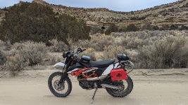
If I were to do it again... I'd allocate a full 8 hours to getting to all of them. I did end up running out of fuel on my KTM 690E and using my backup fuel near what is listed as Rattlesnake Canyon Wildlife Area (which I have never heard of, growing up in the region). Start and finish was off of US Highway 550 just north of Aztec... taking off down the Navajo Dam Road.

Anywho, on to the picutes!
 
PXL_20231212_174246764.MP.jpg

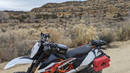
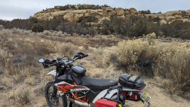
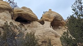
First stop was at some fun rock formations at the end of an interesting single track (call it expert by BDR standards) that I used to ride as a kid.

PXL_20231212_175443231.MP.jpg


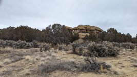
Then a quick stop at some bonus hoodoos listed on Gaia's maps.

PXL_20231212_181253472.MP.jpg_large.jpg


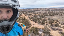
First arch required a little hiking... in fact, if the photo is of me with the arch, there was hiking involved. Yes, I left my helmet on (running fitted earplugs and didn't want to mess with getting them in right each time). No, it wasn't that bad.

PXL_20231212_182117640.MP.jpg_large.jpg


Next arch wasn't exactly rideable... but with the region's tendency to use natural arches as party spots, I had no reservations about riding past discarded mattresses, shoes, and lawn furniture to get the picture.

It really is a shame.

PXL_20231212_182330561.MP.jpg_large.jpg


Arch #3 of the trip was right there next to #2... but even in the wastes of party-land, I couldn't bring myself to bust a moto trail any further.

PXL_20231212_183804777.MP.jpg_large.jpg


Arch #4 took some finding... you have to come at it from the top, not the Gaia path (which is false) that comes closest in from the bottom. I always tried to find these from the bottom, just because it seems like you'd have a better vantage point.

Anywho... “All the way! Double [arches]! Oh, my God—it’s a double [arch] all the way! Whoa, that’s so intense! Whoa, man. . . . Wow! Wow! Whoa! Whoa! Oh, my God! Oh, my God! Oh, my God! Whoa!”

Worth the hike.

PXL_20231212_185218420.MP.jpg_large.jpg


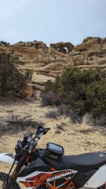
Arch #5 was visible from the road... in a specific spot... through the trees. This will be a trend for the moto-adventurer who doesn't want to hike too much.

PXL_20231212_185401758.MP.jpg


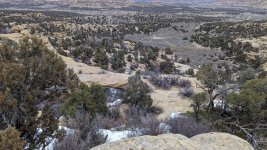
No visible arch here... just a gorgeous northwest NM vista from some single-track on top of the ridge.
 
PXL_20231212_185637290.MP.jpg_large.jpg


Arch #6... a 'minor' arch that found it's way on to the route.

PXL_20231212_190411979.MP.jpg


PXL_20231212_191348589.MP.jpg_large.jpg


PXL_20231212_191757139.MP.jpg_large.jpg


#7 was harder to find... the trail led up some solid single-track with solid rock action... only to find myself hiking around a box canyon trying to find the arch. There was a smaller arch visible from the top, but I figured it couldn't be the 'significant' one I was looking for. Pictures taken, and back on the trail... until I got to the bottom and saw just how big the smaller arch was.

PXL_20231212_192055632.MP.jpg_large.jpg


#8 was another 'minor' visible from the road.

PXL_20231212_193737500.MP.jpg_large.jpg


#9 took a hike.

PXL_20231212_194253622.MP.jpg_large.jpg


#10 is a little hard to see in the picutre... because the upper left is obscured by a tree. Just look at the bottom of the fore-ground rock formation... you really need to be there (trust me, you want to do this ride).
 
PXL_20231212_201008761.MP.jpg_large.jpg


Next up, #11, is a bonus 'minor' arch. I only grabbed pictures of these if it was convenient...

PXL_20231212_201250788.MP.jpg_large.jpg


#12 is another minor... but it's right next to...

PXL_20231212_201317828.MP.jpg_large.jpg


#13, a significant.

PXL_20231212_202204712.MP~2.jpg_large.jpg

PXL_20231212_202349048.MP.jpg_large.jpg


#14 is 'significant' but far from the road...

PXL_20231212_202907980.MP.jpg

PXL_20231212_203221552.MP.jpg_large.jpg

PXL_20231212_203234457.MP.jpg_large.jpg


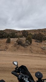
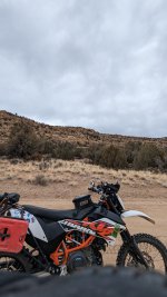
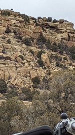
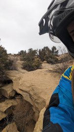
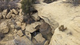
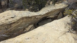
#15 sent me out on some really cool (BDR Expert, lol) single track with solid sandstone paths. It took a lot of hiking to realize that, maybe, some of these 'arches' are really just shallow caves, with maybe a small opening in the back somewhere.
 
Great ride report and pictures! That's an awesome scavenger hunt.

It looks like it's just gorges out there. :D

I see what you did there!

But, seriously... the access to awesome terrain out west is fantastic. I grew up looking out the window of my high school art class wishing school was over so I could ride my dirt bike in these hills...

Out east where I live now... the Appalachians are fun, but not as wild.

The eastern green tunnels have nothing on the western vistas.
 
PXL_20231212_205513174.MP.jpg_large.jpg

PXL_20231212_205525077.MP.jpg_large.jpg


#19 is way up there... and I am starting to realize that Google's photo algorithms (i'm using a Pixel 6) can't handles the color and texture of sandstone.

PXL_20231212_210922761.MP.jpg_large.jpg

PXL_20231212_211118478.MP.jpg_large.jpg

#20 seems like one of those caves that are counted as arches... I didn't go all the way in to confirm if there was some kind of opening in the back.

PXL_20231212_211659714.MP.jpg_large.jpg

PXL_20231212_211718707.MP.jpg_large.jpg


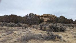
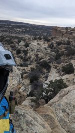
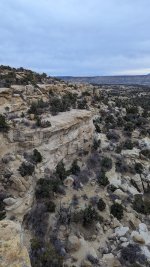
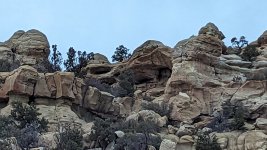
#21 tells us to keep our eyes open. It was far from the road, but visible. Look at the second picture, second ridge from the top, right in the middle.
 
Looks like you found a bunch of them, nice job! I was in that area over the summer looking for some Navajo Publetos, found a few but that terrain hides stuff well. Looks like the sand was nice and moist for you also. I need to get back up there.

I like to take pictures of the arch's when I run across them. This little one is volcanic a had a cool background.
i-RgBd8k9-L.jpg
 
I see snow in some of your pics. How cold was it?
I think it was 45-50* ish. Cold enough for a wool base layer and the insulated jacket liner... Warm enough to switch from cold weather gloves to regular. The snow stuck around on the north slopes and anywhere else a permanent shadow stuck around.
 
I wish that area wasn't such a haul for me (3hrs each way) There's a lot to explore up there and the moto is an great way to do it weather permitting. I did it in the truck this summer but it was Africa hot outside.
 
I see what you did there!
:D

But, seriously... the access to awesome terrain out west is fantastic. I grew up looking out the window of my high school art class wishing school was over so I could ride my dirt bike in these hills...

Out east where I live now... the Appalachians are fun, but not as wild.

The eastern green tunnels have nothing on the western vistas.
I'm always blown away by the pictures from out west. I'll be lucky if I make it out there to ride a handful of times and some people have this in their backyard. 👍

That's funny how the Google Pixel misinterpreted some of those pictures. :lol2
 
I wish that area wasn't such a haul for me (3hrs each way) There's a lot to explore up there and the moto is an great way to do it weather permitting. I did it in the truck this summer but it was Africa hot outside.
3 hours? It's 25 hours for me. :D
 
:D


I'm always blown away by the pictures from out west. I'll be lucky if I make it out there to ride a handful of times and some people have this in their backyard. 👍

That's funny how the Google Pixel misinterpreted some of those pictures. :lol2
I moved here from FL years ago, it blew me away also. I've always been a fan of the old western movies and much of our scenery is like riding through a wester backdrop. One can easily envision (and see) the hardships travelers encountered passing through the area. They film quite a bit in NM so we frequently pass through an areas that were featured in major movies.

These tunnels we're parked at were used for "3:10 to Yuma" and "The Lone Ranger" plus a few others.
i-FFM9Qzw-XL.jpg

If you ever get out this way with your moto and need a guide let me know, I'm retired these days and I'd be glad to show you some of the interesting areas we ride.
 
More to follow tomorrow, getting late here in the mountain time zone...
So... some things happened. My truck and the 690 stayed in NM longer than I did as i flew back to VA to handle kid stuff.

Enjoy the photos with limited commentary... even at 36 years old, memory fades with time.

PXL_20231212_212114130.MP.jpg_large.jpg
PXL_20231212_212425036.MP.jpg_large.jpg
PXL_20231212_212440165.MP.jpg_large.jpg
PXL_20231212_215147540.MP.jpg_large.jpg
PXL_20231212_215153958.MP.jpg_large.jpg
PXL_20231212_215209129.MP.jpg_large.jpg
PXL_20231212_222159673.MP.jpg_large.jpg
PXL_20231212_225644931.MP.jpg_large.jpg
 

Attachments

  • PXL_20231212_223101627.MP.jpg_large (1).jpg_large.jpg
    PXL_20231212_223101627.MP.jpg_large (1).jpg_large.jpg
    6.4 MB · Views: 2
So, ultimately, I didn't hit all the arches I had planned on... I did use my spare 2 gallons of fuel... it took me 6hr 30min... it turned out to be my big ride on the trip.

PXL_20231212_225644931.MP.jpg_large.jpg
PXL_20231212_225853725.MP.jpg_large.jpg
PXL_20231212_230346523.MP.jpg_large.jpg
PXL_20231212_230356684.MP.jpg_large.jpg
PXL_20231212_232549184.MP.jpg_large.jpg
PXL_20231212_232922444.MP.jpg_large.jpg
PXL_20231212_232929271.MP.jpg_large.jpg
PXL_20231212_233513496.MP.jpg_large.jpg
PXL_20231212_233611614.MP.jpg_large.jpg
PXL_20231212_234945681.MP.jpg_large.jpg

I came out to hunt elk. I managed to tag out on day 2. The rest of the vacation was supposed to be gravy to have fun riding, hunting coyotes, etc.

The Arches ride was fun, but very impromptu. The crown jewel was supposed to be a Monticello, Moab, Monticello loop with my brother at the end of the week... turned out my brother was destined to bring my truck, motorcycle, guns, and elk back to NM for me a couple week later when his plane ticket home would be cheap.

Sometimes these moto rides get curtailed by no-kidding family issues... but I chalk it up to part of the adventure. All I can say is, enjoy the ride... but have a plan to get home ASAP if you need to.

Next up... NEBDR?
 
So... some things happened. My truck and the 690 stayed in NM longer than I did as i flew back to VA to handle kid stuff.

Enjoy the photos with limited commentary... even at 36 years old, memory fades with time.

PXL_20231212_212114130.MP.jpg_large.jpg
PXL_20231212_212425036.MP.jpg_large.jpg
PXL_20231212_212440165.MP.jpg_large.jpg
PXL_20231212_215147540.MP.jpg_large.jpg
PXL_20231212_215153958.MP.jpg_large.jpg
PXL_20231212_215209129.MP.jpg_large.jpg
PXL_20231212_222159673.MP.jpg_large.jpg
PXL_20231212_225644931.MP.jpg_large.jpg
Great pictures and hopefully everything is OK back home. 👍🏻
 
Top Bottom Back Refresh